Mitchell (Multi-GNSS)
metadata
Station Name: mchl (mchl00aus)
Location: Walhallow, Queensland, Australia
Ellipsoidal Coordinates:
Latitude: -26.359 degrees
Longitude: 148.145 degrees
Height: 534.591 meters
Station Page at Nevada Geodetic Laboratory
Archives: CDDIS, BKG-IGS, GA
Step 1: GNSS-IR
Generate SNR files for all four constellations over the three-year window. I use -orb gnss-gfz, which includes BeiDou, and -par 10 to use 10 parallel threads.
rinex2snr mchl00aus 2023 1 -doy_end 365 -year_end 2025 -archive ga -orb gnss-gfz -par 10
Set up analysis parameters with all GNSS signals enabled:
gnssir_input mchl -fr 1 20 5 101 102 201 205 206 207 208 301 302 305 306 307 308
Run gnssir across the window:
gnssir mchl 2023 1 -doy_end 365 -year_end 2025 -par 10
Step 2: Soil Moisture
Build tracks.json and vwc_tracks.json from the run’s results:
vwc_input mchl 2023 -year_end 2025
Estimate phase:
phase mchl 2023 1 -doy_end 365 -year_end 2025 -par 10
Run vwc. The code loops over every frequency in vwc_tracks.json and produces a VWC series per constellation. Plots are suppressed when run with multiple frequencies:
vwc mchl 2023 -year_end 2025
Run for a single frequency to show plots:
vwc mchl 2023 -year_end 2025 -fr 101
Results
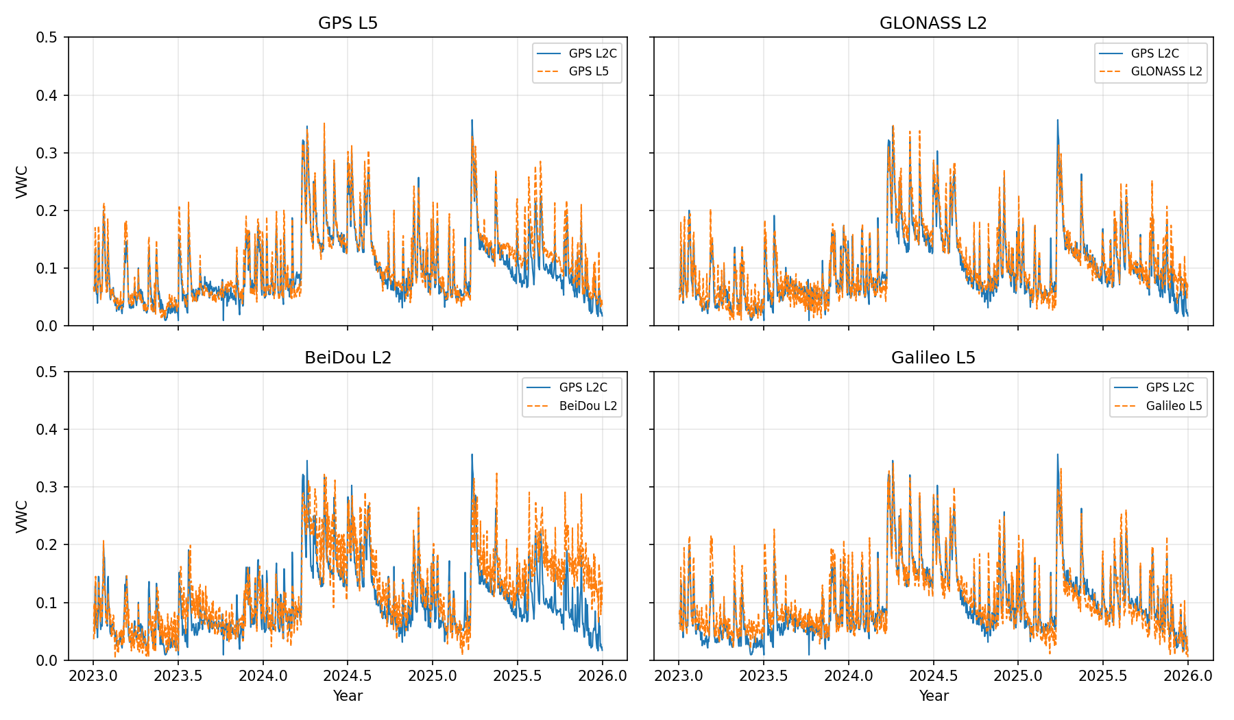
Final VWC, one example frequency per constellation (clockwise from top-left: GPS L5, GLONASS L2, Galileo L5, BeiDou L2). GPS L2C (blue) is overlaid on every panel as a reference:
Per-frequency output files land in $REFL_CODE/Files/mchl/vwc_outputs/<SIGNAL>/mchl_vwc_<SIGNAL>_24hr+0.txt.